Tocht Stappen Martiel - Boucle des dolmens de Martiel - Photo

Boucle des dolmens de Martiel

 tracegps
tracegps

Gebruiker

© OpenStreetMap contributors
Lengte
Lengte
9,4 km
Max. hoogte
Max. hoogte
391 m
Positief hoogteverschil
133 m
Km-Effort
Km-Effort  
11,2 km
Min. hoogte
Min. hoogte
335 m
Negatief hoogteverschil
133 m
Boucle
Boucle
Ja
Datum van aanmaak :
2014-12-10 00:00:00.0
Laatste wijziging :
2014-12-10 00:00:00.0

(1 Bericht)

Stappen
Stappen
2h00
Moeilijkheid : Medium

Scan deze QR-code om de tocht te openen in de SityTrail-applicatie

Gratisgps-wandelapplicatie

Logo SityTrail SityTrail

IGN / Geografische instituten

SityTrail uit de App Store downloaden SityTrail uit Google Play downloaden

Logo SityTrail SityTrail World

De wereld gaat voor u open

SityTrail uit de App Store downloaden SityTrail uit Google Play downloaden SityTrail op Huawei AppGallery downloaden

Over ons

Tocht Stappen van 9,4 km beschikbaar op Occitanië, Aveyron, Martiel. Deze tocht wordt voorgesteld door tracegps.

Beschrijving

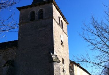
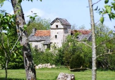
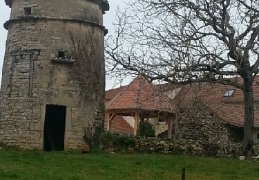
Circuit de randonnée pédestre au balisage jaune avec de nombreux dolmens à voir. Au hameau de Lespinassière, une belle cazelle nous accueille, des maisons typiques avec fours à pain couverts de lauzes ainsi qu'un calvaire sur les ruines d'un petit dolmen (ou sépulture en coffre ?) parsèment ce hameau.

Hoogteprofiel

Foto's

Plaatsbepaling

Land:
France
Regio :
Occitanië
Departement/Provincie :
Aveyron
Gemeente :
Martiel
Locatie:
Unknown
Vertrek:(Dec)
Vertrek:(UTM)
412639 ; 4917779 (31T) N.

Opmerkingen

Gelieve in te loggen om een commentaar of een beoordeling achter te laten


Trop de route, 1 dolmen en écart non visible, 3 dolmens non signalés en écart. A éviter


Wandeltochten in de omgeving

Tocht Mountainbike Martiel - martiel 52 - Photo
Mountainbike
Gerard_Soulie

Mountainbike

Moeilijk
(1)
Martiel, Occitanië, Aveyron, France
53 km | 66 km-effort
4h 23min
Ja
Tocht Stappen Martiel - Circuit du Lac de Bannac - Martiel - Photo
Stappen
tracegps

Stappen

Medium
(1)
Martiel, Occitanië, Aveyron, France
21 km | 25 km-effort
5h 30min
Ja
Tocht Mountainbike La Capelle-Balaguier - la capelle maroule puyjourdes loule anglars les buis lacapelle - Photo
Mountainbike
Gerard_Soulie

Mountainbike

Medium
La Capelle-Balaguier, Occitanië, Aveyron, France
31 km | 40 km-effort
2h 52min
Ja
Tocht Mountainbike La Capelle-Balaguier - la capelle anglars estrabols borieangle croix belge saut mounine trep et retour lac - Photo
Mountainbike
Gerard_Soulie

Mountainbike

Medium
La Capelle-Balaguier, Occitanië, Aveyron, France
32 km | 40 km-effort
3h 8min
Ja
Tocht Stappen Laramière - Fonteynous - Tour du lac de Bannac - Photo
Stappen
clotioneb

Stappen

Heel gemakkelijk
(1)
Laramière, Occitanië, Lot, France
4,5 km | 5,2 km-effort
1h 16min
Ja
Tocht Stappen Laramière - Lac de Bannac - Photo
Stappen
clotioneb

Stappen

Heel gemakkelijk
Laramière, Occitanië, Lot, France
4,2 km | 4,8 km-effort
1h 23min
Ja
Tocht Stappen La Capelle-Balaguier - Boucle de Lacapelle Balaguier - Photo
Stappen
tracegps

Stappen

Medium
La Capelle-Balaguier, Occitanië, Aveyron, France
14 km | 18,4 km-effort
3h 0min
Ja
Tocht Mountainbike La Capelle-Balaguier - VTT La Capelle 31km 750D+(Mag, Chris, Didier,Pascal) 2021-11-16 - Photo
Mountainbike
Levillefranchois

Mountainbike

Gemakkelijk
La Capelle-Balaguier, Occitanië, Aveyron, France
31 km | 39 km-effort
2h 43min
Ja
Tocht Mountainbike Martiel - 30 1 16 essai Bournac Dolmens Maroule les noisetiers Bouygues lantouy les buis croix templiers bournac - Photo
Mountainbike
Gerard_Soulie

Mountainbike

Medium
Martiel, Occitanië, Aveyron, France
29 km | 35 km-effort
3h 21min
Ja


Sluiten
Mijn abonnementen