


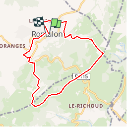
69 RONTALON Les Ravières

trietsch
Gebruiker

Lengte
8,1 km

Max. hoogte
619 m

Positief hoogteverschil
299 m
Km-Effort
12 km

Min. hoogte
406 m

Negatief hoogteverschil
291 m
Boucle
Ja
Datum van aanmaak :
2019-01-15 20:49:32.244
Laatste wijziging :
2020-01-04 20:28:27.972
2h31
Moeilijkheid : Onbekend

Gratisgps-wandelapplicatie
 SityTrail
IGN / Geografische instituten
SityTrail Plus
De wereld gaat voor u open
Over ons
Tocht Stappen van 8,1 km beschikbaar op Auvergne-Rhône-Alpes, Rhône, Rontalon. Deze tocht wordt voorgesteld door trietsch.
Plaatsbepaling
Land:
France
Regio :
Auvergne-Rhône-Alpes
Departement/Provincie :
Rhône
Gemeente :
Rontalon
Locatie:
Unknown
Vertrek:(Dec)
Vertrek:(UTM)
627263 ; 5057606 (31T) N.
Opmerkingen