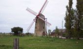
Tocht Fiets Ooie - Circuit des moulins et sécheries  (Oye-Plage) - Photo

Circuit des moulins et sécheries (Oye-Plage)

 tracegps
tracegps

Gebruiker

© OpenStreetMap contributors
Lengte
Lengte
42 km
Max. hoogte
Max. hoogte
7 m
Positief hoogteverschil
113 m
Km-Effort
Km-Effort  
43 km
Min. hoogte
Min. hoogte
-2 m
Negatief hoogteverschil
113 m
Boucle
Boucle
Ja
Datum van aanmaak :
2014-12-10 00:00:00.0
Laatste wijziging :
2014-12-10 00:00:00.0

(1 Bericht)

Fiets
Fiets
2h45
Moeilijkheid : Medium

Scan deze QR-code om de tocht te openen in de SityTrail-applicatie

Gratisgps-wandelapplicatie

Logo SityTrail SityTrail

IGN / Geografische instituten

SityTrail uit de App Store downloaden SityTrail uit Google Play downloaden

Logo SityTrail SityTrail World

De wereld gaat voor u open

SityTrail uit de App Store downloaden SityTrail uit Google Play downloaden SityTrail op Huawei AppGallery downloaden

Over ons

Tocht Fiets van 42 km beschikbaar op Hauts-de-France, Pas-de-Calais, Ooie. Deze tocht wordt voorgesteld door tracegps.

Beschrijving

Circuit proposé par la Communauté de Communes de la région d’Audruiq. Départ de la mairie d’Oye-Plage Patrimoine incontournable de notre territoire, l’histoire des moulins et des sécheries est retracée à travers cette randonnée de 42kms, en traversant Oye-Plage, Offekerque, Guemps et d’autres communes. L’histoire des moulins et des sécheries n’aura plus de secret pour vous avec le plan et le guide. Ce circuit a été numérisé par les randonneurs du CODEPEM. Merci à Jean-Marie.

Hoogteprofiel

Foto's

Plaatsbepaling

Land:
France
Regio :
Hauts-de-France
Departement/Provincie :
Pas-de-Calais
Gemeente :
Ooie
Locatie:
Unknown
Vertrek:(Dec)
Vertrek:(UTM)
432770 ; 5647824 (31U) N.

Opmerkingen

Gelieve in te loggen om een commentaar of een beoordeling achter te laten


Le plat pays


Wandeltochten in de omgeving

Tocht Stappen Ooie - Le platier d'oye 6km - Photo
Stappen
Templeuveenmarche

Stappen

Medium
(1)
Ooie, Hauts-de-France, Pas-de-Calais, France
5,8 km | 6 km-effort
1h 22min
Ja
Tocht Stappen Ooie - platier d'oye - Photo
Stappen
fizz1212

Stappen

Heel gemakkelijk
Ooie, Hauts-de-France, Pas-de-Calais, France
4,7 km | 4,9 km-effort
1h 38min
Ja
Tocht Stappen Ooie - Sentier du Platier d'Oye (Oye-Plage) - Photo
Stappen
tracegps

Stappen

Gemakkelijk
(1)
Ooie, Hauts-de-France, Pas-de-Calais, France
3,8 km | 4 km-effort
1h 0min
Ja
Tocht Stappen Ooie - L'Ansérienne (Oye-Plage) - Photo
Stappen
tracegps

Stappen

Moeilijk
Ooie, Hauts-de-France, Pas-de-Calais, France
16,2 km | 16,9 km-effort
4h 0min
Ja
Tocht Stappen Grevelingen - Gravelines 16/04/22 - Photo
Stappen
Isabelle1969

Stappen

Gemakkelijk
Grevelingen, Hauts-de-France, Noorderdepartement, France
1,7 km | 1,8 km-effort
8h 18min
Neen
Tocht Stappen Ooie - rando oiseaux  - Photo
Stappen
Salers

Stappen

Gemakkelijk
Ooie, Hauts-de-France, Pas-de-Calais, France
9,5 km | 10 km-effort
3h 27min
Ja
Tocht Stappen Ooie - Oye plage - Photo
Stappen
jeanluc59

Stappen

Gemakkelijk
(1)
Ooie, Hauts-de-France, Pas-de-Calais, France
10,2 km | 10,7 km-effort
2h 39min
Ja
Tocht Fiets Ooie - Du platier d'Oye au pays de Bergues - Photo
Fiets
Baltykatt

Fiets

Moeilijk
Ooie, Hauts-de-France, Pas-de-Calais, France
91 km | 92 km-effort
5h 35min
Ja
Tocht Stappen Ooie - platier - Photo
Stappen
alialex

Stappen

Heel gemakkelijk
(1)
Ooie, Hauts-de-France, Pas-de-Calais, France
3,8 km | 4,1 km-effort
1h 10min
Neen


Sluiten
Mijn abonnementen