Tocht Mountainbike Mesnil-en-Ouche - Circuit de la campagne des Lisses - La Barre-en-Ouche - Photo

Circuit de la campagne des Lisses - La Barre-en-Ouche

 tracegps
tracegps

Gebruiker

© OpenStreetMap contributors
Lengte
Lengte
11,1 km
Max. hoogte
Max. hoogte
198 m
Positief hoogteverschil
52 m
Km-Effort
Km-Effort  
11,7 km
Min. hoogte
Min. hoogte
177 m
Negatief hoogteverschil
52 m
Boucle
Boucle
Ja
Datum van aanmaak :
2014-12-10 00:00:00.0
Laatste wijziging :
2014-12-10 00:00:00.0

(0 Bericht)

Mountainbike
Mountainbike
1h30
Moeilijkheid : Medium

Scan deze QR-code om de tocht te openen in de SityTrail-applicatie

Gratisgps-wandelapplicatie

Logo SityTrail SityTrail

IGN / Geografische instituten

SityTrail uit de App Store downloaden SityTrail uit Google Play downloaden

Logo SityTrail SityTrail World

De wereld gaat voor u open

SityTrail uit de App Store downloaden SityTrail uit Google Play downloaden SityTrail op Huawei AppGallery downloaden

Over ons

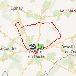
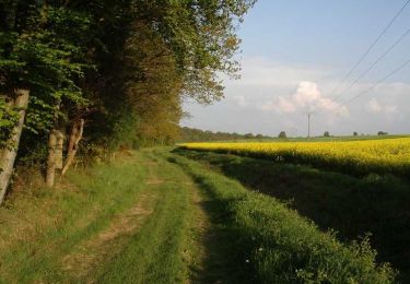
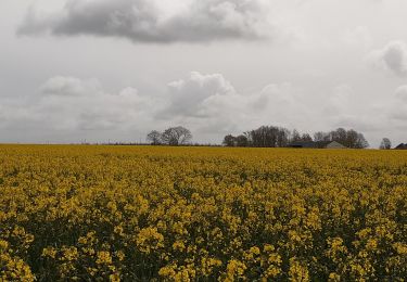
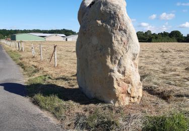
Tocht Mountainbike van 11,1 km beschikbaar op Normandië, Eure, Mesnil-en-Ouche. Deze tocht wordt voorgesteld door tracegps.

Beschrijving

Circuit proposé par la Communauté de Communes du canton de Beaumesnil et l’Office de Tourisme de Beaumesnil. Départ derrière l’église de La Barre-en-Ouche. Retrouvez ce circuit, parmi 17 autres, sur le dépliant proposé par l’office de Tourisme.

Hoogteprofiel

Foto's

Plaatsbepaling

Land:
France
Regio :
Normandië
Departement/Provincie :
Eure
Gemeente :
Mesnil-en-Ouche
Locatie:
Unknown
Vertrek:(Dec)
Vertrek:(UTM)
329055 ; 5424148 (31U) N.

Wandeltochten in de omgeving

Tocht Stappen Mesnil-en-Ouche - Circuit des vallons d'Epinay  - Photo
Stappen
tracegps

Stappen

Medium
(2)
Mesnil-en-Ouche, Normandië, Eure, France
11,1 km | 12,7 km-effort
2h 45min
Ja
Tocht Mountainbike Mesnil-en-Ouche - Circuit de la Pinçonniére - Bosc - Renoult-en-Ouche - Photo
Mountainbike
tracegps

Mountainbike

Gemakkelijk
Mesnil-en-Ouche, Normandië, Eure, France
7,7 km | 8,4 km-effort
1h 0min
Ja
Tocht Stappen Mesnil-en-Ouche - Circuit de la Pinçonniére - Bosc - Renoult-en-Ouche - Photo
Stappen
tracegps

Stappen

Medium
Mesnil-en-Ouche, Normandië, Eure, France
7,7 km | 8,4 km-effort
2h 0min
Ja
Tocht Stappen Mesnil-en-Ouche - Circuit des bois de St Ouen - Gisay-la-Coudre - Photo
Stappen
tracegps

Stappen

Moeilijk
Mesnil-en-Ouche, Normandië, Eure, France
16,3 km | 17,6 km-effort
4h 0min
Ja
Tocht Mountainbike Mesnil-en-Ouche - Circuit des vallons d'Epinay  - Photo
Mountainbike
tracegps

Mountainbike

Medium
Mesnil-en-Ouche, Normandië, Eure, France
11,1 km | 12,7 km-effort
1h 30min
Ja
Tocht Stappen Mesnil-en-Ouche - Epinay - Photo
Stappen
werth

Stappen

Medium
Mesnil-en-Ouche, Normandië, Eure, France
9,8 km | 11,2 km-effort
2h 52min
Ja
Tocht Stappen Mesnil-en-Ouche - Circuit de la campagne des Lisses - La Barre-en-Ouche - Photo
Stappen
tracegps

Stappen

Medium
Mesnil-en-Ouche, Normandië, Eure, France
11,1 km | 11,7 km-effort
2h 45min
Ja
Tocht Stappen Mesnil-en-Ouche - Epinay - Photo
Stappen
werth

Stappen

Medium
Mesnil-en-Ouche, Normandië, Eure, France
11,8 km | 13,4 km-effort
2h 52min
Ja
Tocht Stappen Bois-Anzeray - BOIS ANZERAY - Photo
Stappen
dominiquelaudou

Stappen

Medium
Bois-Anzeray, Normandië, Eure, France
10,1 km | 11,3 km-effort
2h 30min
Ja


Sluiten
Mijn abonnementen