


2018-02-05 TORRE LA SAL NORD

rousseau.mich
Gebruiker
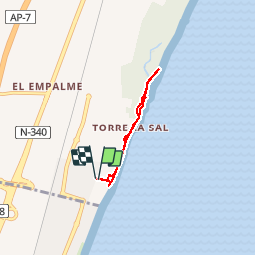

Lengte
4,4 km

Max. hoogte
4 m

Positief hoogteverschil
11 m
Km-Effort
4,5 km

Min. hoogte
-3 m

Negatief hoogteverschil
10 m
Boucle
Ja
Datum van aanmaak :
2019-02-05 20:55:30.955
Laatste wijziging :
2019-09-10 07:05:55.188
1h32
Moeilijkheid : Onbekend

Gratisgps-wandelapplicatie
 SityTrail
IGN / Geografische instituten
SityTrail Plus
De wereld gaat voor u open
Over ons
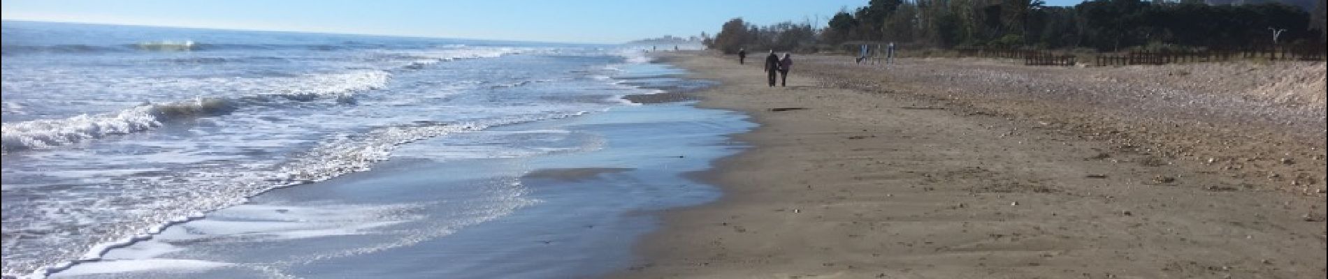
Tocht Stappen van 4,4 km beschikbaar op Valencia, Castelló / Castellón, Cabanes. Deze tocht wordt voorgesteld door rousseau.mich.
Foto's


Plaatsbepaling
Land:
Spain
Regio :
Valencia
Departement/Provincie :
Castelló / Castellón
Gemeente :
Cabanes
Locatie:
Unknown
Vertrek:(Dec)
Vertrek:(UTM)
258030 ; 4445776 (31T) N.
Opmerkingen