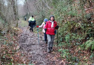
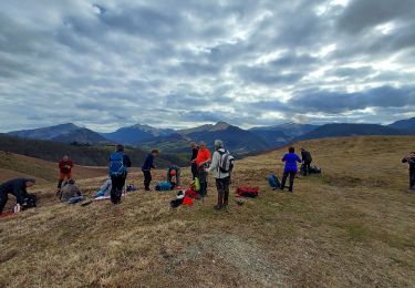
Tocht Stappen Lanne-en-Barétous - Chemin des pantières - Lanne en Barétous - Photo

Chemin des pantières - Lanne en Barétous

 tracegps
tracegps

Gebruiker

© OpenStreetMap contributors
Lengte
Lengte
7,7 km
Max. hoogte
Max. hoogte
536 m
Positief hoogteverschil
267 m
Km-Effort
Km-Effort  
11,3 km
Min. hoogte
Min. hoogte
312 m
Negatief hoogteverschil
267 m
Boucle
Boucle
Ja
Datum van aanmaak :
2014-12-10 00:00:00.0
Laatste wijziging :
2014-12-10 00:00:00.0

(2 Bericht)

Stappen
Stappen
2h30
Moeilijkheid : Medium

Scan deze QR-code om de tocht te openen in de SityTrail-applicatie

Gratisgps-wandelapplicatie

Logo SityTrail SityTrail

IGN / Geografische instituten

SityTrail uit de App Store downloaden SityTrail uit Google Play downloaden

Logo SityTrail SityTrail World

De wereld gaat voor u open

SityTrail uit de App Store downloaden SityTrail uit Google Play downloaden SityTrail op Huawei AppGallery downloaden

Over ons

Tocht Stappen van 7,7 km beschikbaar op Nieuw-Aquitanië, Pyrénées-Atlantiques, Lanne-en-Barétous. Deze tocht wordt voorgesteld door tracegps.

Beschrijving

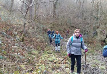
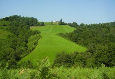
Belle boucle autour du village de Lanne en Barétous qui entoure le Camp de la Salière et donne accès à la chasse traditionnelle de la palombe: la chasse aux filets. Retrouvez d’autres informations et la fiche descriptive sur le site Pays Basque et Béarn.

Hoogteprofiel

Foto's

Plaatsbepaling

Land:
France
Regio :
Nieuw-Aquitanië
Departement/Provincie :
Pyrénées-Atlantiques
Gemeente :
Lanne-en-Barétous
Locatie:
Unknown
Vertrek:(Dec)
Vertrek:(UTM)
682441 ; 4775723 (30T) N.

Opmerkingen

Gelieve in te loggen om een commentaar of een beoordeling achter te laten


tres belle ballade ombragee le long du ruisseau. nous avons adores!


Wandeltochten in de omgeving

Tocht Stappen Aramits - ARAMITS
Stappen
GUIDE
marmotte65

Stappen

Moeilijk
Aramits, Nieuw-Aquitanië, Pyrénées-Atlantiques, France
11,1 km | 16 km-effort
3h 3min
Ja
Tocht Stappen Aramits - ARAMITS reco une virée chez les mousquetaires  - Photo
Stappen
GUIDE
marmotte65

Stappen

Medium
Aramits, Nieuw-Aquitanië, Pyrénées-Atlantiques, France
11,3 km | 16,1 km-effort
4h 56min
Ja
Tocht Te voet Arette - ARETTE le tour du Soum de Casteigt
Te voet
GUIDE
marmotte65

Te voet

Gemakkelijk
Arette, Nieuw-Aquitanië, Pyrénées-Atlantiques, France
7,8 km | 11,6 km-effort
2h 37min
Ja
Tocht Te voet Arette - Crêtes d'Issor - Photo
Te voet
GUIDE
marmotte65

Te voet

Medium
Arette, Nieuw-Aquitanië, Pyrénées-Atlantiques, France
8,7 km | 12,8 km-effort
Onbekend
Ja
Tocht Stappen Lanne-en-Barétous - lanneenbaretous fait - Photo
Stappen
LouisROGER

Stappen

Heel gemakkelijk
Lanne-en-Barétous, Nieuw-Aquitanië, Pyrénées-Atlantiques, France
11,6 km | 16 km-effort
5h 34min
Neen
Tocht Stappen Aramits - De Aramits à Ance - Photo
Stappen
tracegps

Stappen

Moeilijk
Aramits, Nieuw-Aquitanië, Pyrénées-Atlantiques, France
13,6 km | 19,8 km-effort
3h 40min
Neen
Tocht Stappen Lanne-en-Barétous - G4 lanne baretous fait - Photo
Stappen
LouisROGER

Stappen

Medium
Lanne-en-Barétous, Nieuw-Aquitanië, Pyrénées-Atlantiques, France
8,6 km | 11,6 km-effort
3h 1min
Ja
Tocht Stappen Aramits - G3Aramits fait2022 - Photo
Stappen
LouisROGER

Stappen

Moeilijk
Aramits, Nieuw-Aquitanië, Pyrénées-Atlantiques, France
11,3 km | 16,1 km-effort
3h 14min
Ja
Tocht Stappen Lanne-en-Barétous - G4 Lanne Boucle Nord Vrai - Photo
Stappen
almitpau

Stappen

Medium
Lanne-en-Barétous, Nieuw-Aquitanië, Pyrénées-Atlantiques, France
8,9 km | 12 km-effort
2h 59min
Ja


Sluiten
Mijn abonnementen