


Tuc de l'Etang en boucle

chrisgps
Gebruiker

Lengte
14,7 km

Max. hoogte
1806 m

Positief hoogteverschil
1016 m
Km-Effort
28 km

Min. hoogte
910 m

Negatief hoogteverschil
1018 m
Boucle
Ja
Datum van aanmaak :
2019-05-08 15:15:45.293
Laatste wijziging :
2019-05-08 15:15:46.0
5h48
Moeilijkheid : Medium

Gratisgps-wandelapplicatie
 SityTrail
IGN / Geografische instituten
SityTrail Plus
De wereld gaat voor u open
Over ons
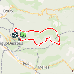
Tocht Stappen van 14,7 km beschikbaar op Occitanië, Haute-Garonne, Boutx. Deze tocht wordt voorgesteld door chrisgps.
Foto's


Plaatsbepaling
Land:
France
Regio :
Occitanië
Departement/Provincie :
Haute-Garonne
Gemeente :
Boutx
Locatie:
Unknown
Vertrek:(Dec)
Vertrek:(UTM)
314573 ; 4751205 (31T) N.
Opmerkingen