


Valbonnais Canal Beaumont StLaurent

Orcal37
Gebruiker GUIDE

Lengte
6,8 km

Max. hoogte
977 m

Positief hoogteverschil
132 m
Km-Effort
8,6 km

Min. hoogte
919 m

Negatief hoogteverschil
133 m
Boucle
Ja
Datum van aanmaak :
2019-05-07 01:56:00.968
Laatste wijziging :
2021-09-07 15:12:10.601
1h35
Moeilijkheid : Gemakkelijk

Gratisgps-wandelapplicatie
 SityTrail
IGN / Geografische instituten
SityTrail Plus
De wereld gaat voor u open
Over ons
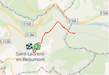
Tocht Stappen van 6,8 km beschikbaar op Auvergne-Rhône-Alpes, Isère, Saint-Laurent-en-Beaumont. Deze tocht wordt voorgesteld door Orcal37.
Beschrijving
Valbonnais - Canal du Beaumont -St-Laurent
Foto's


Plaatsbepaling
Land:
France
Regio :
Auvergne-Rhône-Alpes
Departement/Provincie :
Isère
Gemeente :
Saint-Laurent-en-Beaumont
Locatie:
Unknown
Vertrek:(Dec)
Vertrek:(UTM)
725180 ; 4973494 (31T) N.
Opmerkingen