


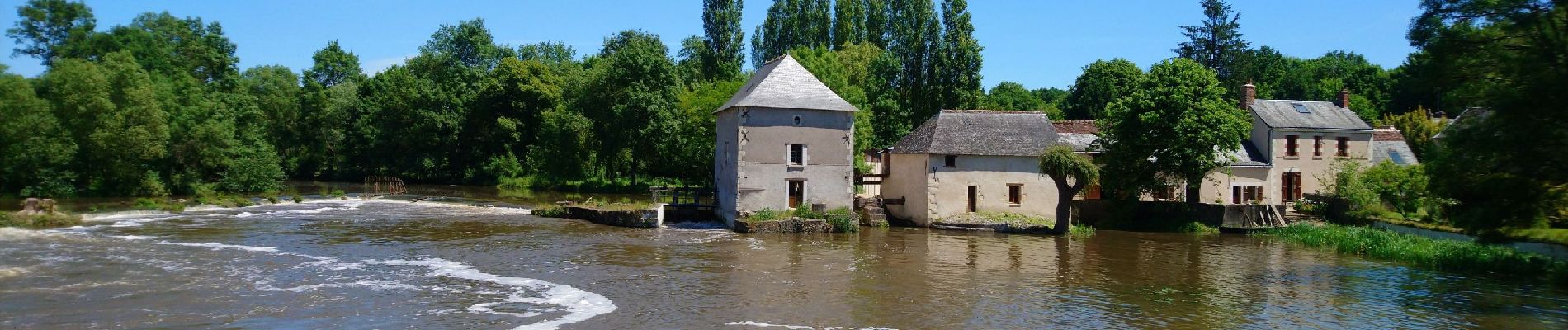
Pont-de-Ruan - circuit 1 Thilouze - 15.7km 120m 2h45 - 2017 04 16

Orcal37
Gebruiker GUIDE
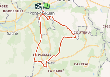

Lengte
15,7 km

Max. hoogte
106 m

Positief hoogteverschil
131 m
Km-Effort
17,4 km

Min. hoogte
47 m

Negatief hoogteverschil
131 m
Boucle
Ja
Datum van aanmaak :
2019-05-07 01:57:09.272
Laatste wijziging :
2022-09-08 16:55:58.736
2h45
Moeilijkheid : Gemakkelijk

Gratisgps-wandelapplicatie
 SityTrail
IGN / Geografische instituten
SityTrail Plus
De wereld gaat voor u open
Over ons
Tocht Stappen van 15,7 km beschikbaar op Centre-Val de Loire, Indre-et-Loire, Pont-de-Ruan. Deze tocht wordt voorgesteld door Orcal37.
Beschrijving
Pont-de-Ruan - circuit 1 Thilouze - 15.7km 120m 2h45 - 2017 04 16
Foto's


Plaatsbepaling
Land:
France
Regio :
Centre-Val de Loire
Departement/Provincie :
Indre-et-Loire
Gemeente :
Pont-de-Ruan
Locatie:
Unknown
Vertrek:(Dec)
Vertrek:(UTM)
316579 ; 5237053 (31T) N.
Opmerkingen