


criel avec christophe

cbenoit38
Gebruiker

Lengte
9,9 km

Max. hoogte
402 m

Positief hoogteverschil
134 m
Km-Effort
11,6 km

Min. hoogte
349 m

Negatief hoogteverschil
133 m
Boucle
Ja
Datum van aanmaak :
2019-06-16 07:29:06.112
Laatste wijziging :
2019-06-16 07:29:06.255
1h00
Moeilijkheid : Onbekend

Gratisgps-wandelapplicatie
 SityTrail
IGN / Geografische instituten
SityTrail Plus
De wereld gaat voor u open
Over ons
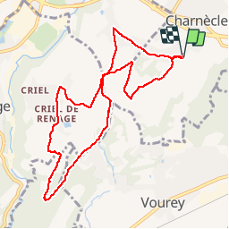
Tocht Lopen van 9,9 km beschikbaar op Auvergne-Rhône-Alpes, Isère, Charnècles. Deze tocht wordt voorgesteld door cbenoit38.
Beschrijving
Préparation CHARAVINES
Plaatsbepaling
Land:
France
Regio :
Auvergne-Rhône-Alpes
Departement/Provincie :
Isère
Gemeente :
Charnècles
Locatie:
Unknown
Vertrek:(Dec)
Vertrek:(UTM)
697791 ; 5023650 (31T) N.
Opmerkingen