


soum de lascours aléas bis

harydh
Gebruiker GUIDE
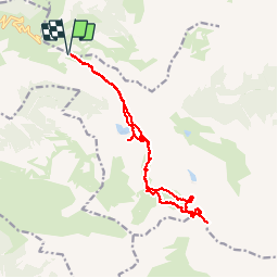

Lengte
18 km

Max. hoogte
2472 m

Positief hoogteverschil
1109 m
Km-Effort
33 km

Min. hoogte
1558 m

Negatief hoogteverschil
1108 m
Boucle
Ja
Datum van aanmaak :
2014-12-10 00:00:00.0
Laatste wijziging :
2014-12-10 00:00:00.0
5h55
Moeilijkheid : Medium

Gratisgps-wandelapplicatie
 SityTrail
IGN / Geografische instituten
SityTrail Plus
De wereld gaat voor u open
Over ons
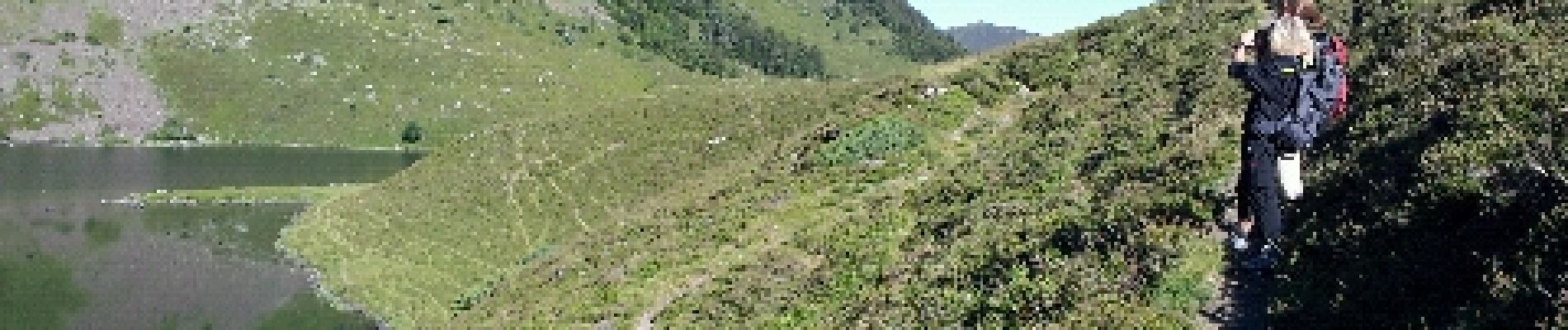
Tocht Stappen van 18 km beschikbaar op Occitanië, Hautes-Pyrénées, Beaucens. Deze tocht wordt voorgesteld door harydh.
Foto's


42 fotos in totaal. Klik op een foto om ze allemaal in de galerij weer te geven.
Plaatsbepaling
Land:
France
Regio :
Occitanië
Departement/Provincie :
Hautes-Pyrénées
Gemeente :
Beaucens
Locatie:
Unknown
Vertrek:(Dec)
Vertrek:(UTM)
255846 ; 4761657 (31T) N.
Opmerkingen