


64 Pierre St Martin- soum couy

trietsch
Gebruiker
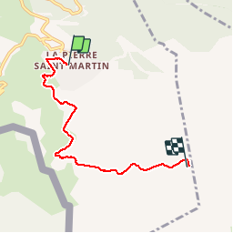

Lengte
5,3 km

Max. hoogte
2142 m

Positief hoogteverschil
508 m
Km-Effort
10,4 km

Min. hoogte
1640 m

Negatief hoogteverschil
33 m
Boucle
Neen
Datum van aanmaak :
2015-06-15 00:00:00.0
Laatste wijziging :
2020-01-04 20:30:55.464
3h00
Moeilijkheid : Medium

Gratisgps-wandelapplicatie
 SityTrail
IGN / Geografische instituten
SityTrail Plus
De wereld gaat voor u open
Over ons
Tocht Stappen van 5,3 km beschikbaar op Nieuw-Aquitanië, Pyrénées-Atlantiques, Arette. Deze tocht wordt voorgesteld door trietsch.
Beschrijving
Jusqu à l arrivée du telesiege
Plaatsbepaling
Land:
France
Regio :
Nieuw-Aquitanië
Departement/Provincie :
Pyrénées-Atlantiques
Gemeente :
Arette
Locatie:
Unknown
Vertrek:(Dec)
Vertrek:(UTM)
683882 ; 4760697 (30T) N.
Opmerkingen
très pratique