


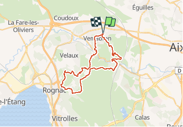
ventabren croix rognac

prof_physique
Gebruiker

Lengte
30 km

Max. hoogte
268 m

Positief hoogteverschil
640 m
Km-Effort
38 km

Min. hoogte
75 m

Negatief hoogteverschil
640 m
Boucle
Ja
Datum van aanmaak :
2014-12-10 00:00:00.0
Laatste wijziging :
2014-12-10 00:00:00.0
4h23
Moeilijkheid : Moeilijk

Gratisgps-wandelapplicatie
 SityTrail
IGN / Geografische instituten
SityTrail Plus
De wereld gaat voor u open
Over ons
Tocht Lopen van 30 km beschikbaar op Provence-Alpes-Côte d'Azur, Bouches-du-Rhône, Ventabren. Deze tocht wordt voorgesteld door prof_physique.
Plaatsbepaling
Land:
France
Regio :
Provence-Alpes-Côte d'Azur
Departement/Provincie :
Bouches-du-Rhône
Gemeente :
Ventabren
Locatie:
Unknown
Vertrek:(Dec)
Vertrek:(UTM)
685889 ; 4823676 (31T) N.
Opmerkingen