


Zermatt - In den Bach

heinzwei
Gebruiker
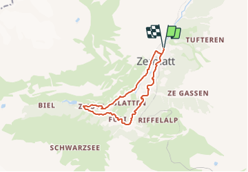

Lengte
11,2 km

Max. hoogte
1962 m

Positief hoogteverschil
420 m
Km-Effort
16,8 km

Min. hoogte
1593 m

Negatief hoogteverschil
419 m
Boucle
Ja
Datum van aanmaak :
2014-12-10 00:00:00.0
Laatste wijziging :
2014-12-10 00:00:00.0
4h00
Moeilijkheid : Gemakkelijk

Gratisgps-wandelapplicatie
 SityTrail
IGN / Geografische instituten
SityTrail Plus
De wereld gaat voor u open
Over ons
Tocht Andere activiteiten van 11,2 km beschikbaar op Valais/Wallis, Visp, Zermatt. Deze tocht wordt voorgesteld door heinzwei.
Beschrijving
Parcours fait le 15.02.2013, par un temps nuageux avec petites chutes de neige.
Journée idyllique malgré le temps gris
Plaatsbepaling
Land:
Switzerland
Regio :
Valais/Wallis
Departement/Provincie :
Visp
Gemeente :
Zermatt
Locatie:
Unknown
Vertrek:(Dec)
Vertrek:(UTM)
403518 ; 5097768 (32T) N.
Opmerkingen