Tocht Fiets Dole - Chamblay-St.Cyr-Port.Lesney - Photo

Chamblay-St.Cyr-Port.Lesney

 albert39
albert39

Gebruiker

© OpenStreetMap contributors
Lengte
Lengte
92 km
Max. hoogte
Max. hoogte
292 m
Positief hoogteverschil
887 m
Km-Effort
Km-Effort  
104 km
Min. hoogte
Min. hoogte
193 m
Negatief hoogteverschil
887 m
Boucle
Boucle
Ja
Datum van aanmaak :
2014-12-10 00:00:00.0
Laatste wijziging :
2014-12-10 00:00:00.0

(0 Bericht)

Fiets
Fiets
4h21
Moeilijkheid : Zeer moeilijk

Scan deze QR-code om de tocht te openen in de SityTrail-applicatie

Gratisgps-wandelapplicatie

Logo SityTrail SityTrail

IGN / Geografische instituten

SityTrail uit de App Store downloaden SityTrail uit Google Play downloaden

Logo SityTrail SityTrail Plus

De wereld gaat voor u open

SityTrail uit de App Store downloaden SityTrail uit Google Play downloaden SityTrail op Huawei AppGallery downloaden

Over ons

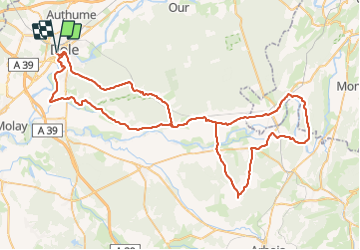
Tocht Fiets van 92 km beschikbaar op Bourgondië-Franche-Comté, Jura, Dole. Deze tocht wordt voorgesteld door albert39.

Beschrijving

Circuit relevé avec de belle monté.Dole, Chatelay, Chamblay,St Cyr, Villers.Farlay,Cramans, Port.Lesney, Buffard, Arc et Senans, Montbarrey, La Vielle loye, Rf du Grand Contour et retour. 2ème partie (Port lesney) exigeante avec pas mal de bosse !    

Hoogteprofiel

Plaatsbepaling

Land:
France
Regio :
Bourgondië-Franche-Comté
Departement/Provincie :
Jura
Gemeente :
Dole
Locatie:
Unknown
Vertrek:(Dec)
Vertrek:(UTM)
688443 ; 5218073 (31T) N.


Sluiten
Mijn abonnementen