


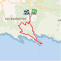
luminy-morgiou-cap morgiou-aiguille sormiou-col morgiou-estampons

mapomme
Gebruiker


6h24
Moeilijkheid : Onbekend

Gratisgps-wandelapplicatie
 SityTrail
IGN / Geografische instituten
SityTrail Plus
De wereld gaat voor u open
Over ons
Tocht Stappen van 14,8 km beschikbaar op Provence-Alpes-Côte d'Azur, Bouches-du-Rhône, Marseille. Deze tocht wordt voorgesteld door mapomme.
Beschrijving
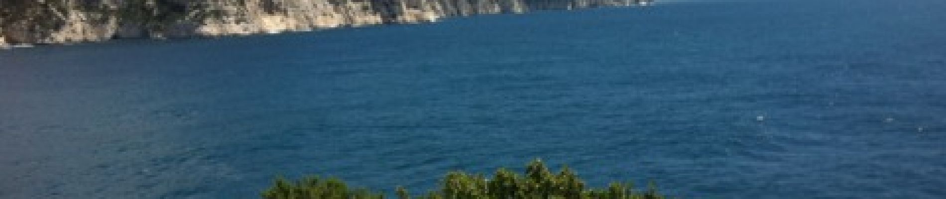
Une très tres belle ballade-assez longue-très beaux points de vue-bcp hors sentiers balisés. Boucle perso qui surprendra même les habitues. Permet d échapper à la foule et de voir des panoramas exceptionnels
Foto's


Plaatsbepaling
Opmerkingen
très bien. merci