


étoiles

harydh
Gebruiker GUIDE
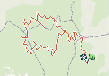

Lengte
19 km

Max. hoogte
530 m

Positief hoogteverschil
455 m
Km-Effort
25 km

Min. hoogte
324 m

Negatief hoogteverschil
455 m
Boucle
Ja
Datum van aanmaak :
2014-12-10 00:00:00.0
Laatste wijziging :
2014-12-10 00:00:00.0
1h40
Moeilijkheid : Gemakkelijk

Gratisgps-wandelapplicatie
 SityTrail
IGN / Geografische instituten
SityTrail Plus
De wereld gaat voor u open
Over ons
Tocht Mountainbike van 19 km beschikbaar op Provence-Alpes-Côte d'Azur, Bouches-du-Rhône, Allauch. Deze tocht wordt voorgesteld door harydh.
Beschrijving
une vue splendide sur la baie de Marseille


Plaatsbepaling
Land:
France
Regio :
Provence-Alpes-Côte d'Azur
Departement/Provincie :
Bouches-du-Rhône
Gemeente :
Allauch
Locatie:
Unknown
Vertrek:(Dec)
Vertrek:(UTM)
701268 ; 4805315 (31T) N.
Opmerkingen