Tocht Stappen Aumessas - mouzoules - Photo
 vertygo
vertygo

Gebruiker

© OpenStreetMap contributors
Lengte
Lengte
24 km
Max. hoogte
Max. hoogte
1282 m
Positief hoogteverschil
671 m
Km-Effort
Km-Effort  
33 km
Min. hoogte
Min. hoogte
735 m
Negatief hoogteverschil
685 m
Boucle
Boucle
Ja
Datum van aanmaak :
2018-09-04 16:27:28.525
Laatste wijziging :
2018-09-04 16:59:16.924

(0 Bericht)

Stappen
Stappen
7h04
Moeilijkheid : Zeer moeilijk

Scan deze QR-code om de tocht te openen in de SityTrail-applicatie

Gratisgps-wandelapplicatie

Logo SityTrail SityTrail

IGN / Geografische instituten

SityTrail uit de App Store downloaden SityTrail uit Google Play downloaden

Logo SityTrail SityTrail Plus

De wereld gaat voor u open

SityTrail uit de App Store downloaden SityTrail uit Google Play downloaden SityTrail op Huawei AppGallery downloaden

Over ons

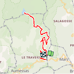
Tocht Stappen van 24 km beschikbaar op Occitanië, Gard, Aumessas. Deze tocht wordt voorgesteld door vertygo.

Beschrijving

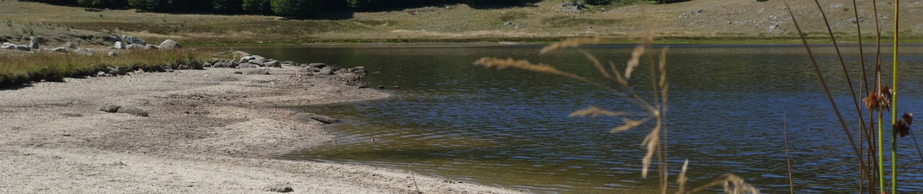
Départ au niveau de col de Mouzoules puis route forestière assurant une montée très uniforme, voire un peu monotone, jusqu'au lac des Pises.

Voir des photos et d'autres idées de randonnées sur www.vertygo.fr

Hoogteprofiel

Foto's

Plaatsbepaling

Land:
France
Regio :
Occitanië
Departement/Provincie :
Gard
Gemeente :
Aumessas
Locatie:
Unknown
Vertrek:(Dec)
Vertrek:(UTM)
542937 ; 4872085 (31T) N.


Sluiten
Mijn abonnementen