


Sentiers_GR : GR-570

Visit Luxembourg
Randonnées de Visit Luxembourg. GUIDE+
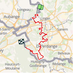

Lengte
25 km

Max. hoogte
433 m

Positief hoogteverschil
561 m
Km-Effort
33 km

Min. hoogte
269 m

Negatief hoogteverschil
618 m
Boucle
Neen
Datum van aanmaak :
2014-12-10 00:00:00.0
Laatste wijziging :
2014-12-10 00:00:00.0
--
Moeilijkheid : Onbekend

Gratisgps-wandelapplicatie
 SityTrail
IGN / Geografische instituten
SityTrail Plus
De wereld gaat voor u open
Over ons
Tocht Stappen van 25 km beschikbaar op Wallonië, Luxemburg, Aubange. Deze tocht wordt voorgesteld door Visit Luxembourg.
Plaatsbepaling
Land:
Belgium
Regio :
Wallonië
Departement/Provincie :
Luxemburg
Gemeente :
Aubange
Locatie:
Athus
Vertrek:(Dec)
Vertrek:(UTM)
707106 ; 5495013 (31U) N.
Opmerkingen