


activity_3184198477

fabwin
Gebruiker GUIDE


2h52
Moeilijkheid : Zeer moeilijk

Gratisgps-wandelapplicatie
 SityTrail
IGN / Geografische instituten
SityTrail Plus
De wereld gaat voor u open
Over ons
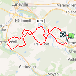
Tocht Mountainbike van 38 km beschikbaar op Grand Est, Meurthe-et-Moselle, Saint-Clément. Deze tocht wordt voorgesteld door fabwin.
Beschrijving
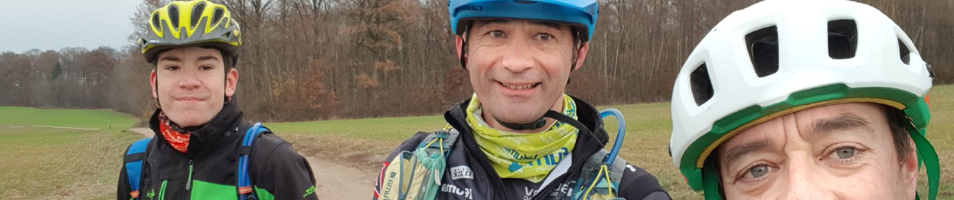
Avec Séb et Luca.
38km et 346m de D .
Un petit peu de soleil au départ et un grand soleil au retour, n'est-ce pas Luca!!! ;););)
On a découvert quelques chemins qu'on ne connaissait pas.
Un retour plus roulant mené à belle allure ou l'aspiration en a aidée certain.
Bref ce fut sympa!!
Foto's


Plaatsbepaling
Opmerkingen