


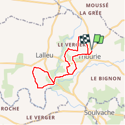
Circuit-Corbinières-Thourie

chasle
Gebruiker

Lengte
12,7 km

Max. hoogte
94 m

Positief hoogteverschil
187 m
Km-Effort
15,2 km

Min. hoogte
35 m

Negatief hoogteverschil
187 m
Boucle
Ja
Datum van aanmaak :
2019-01-10 23:22:09.522
Laatste wijziging :
2019-01-10 23:22:09.522

Gratisgps-wandelapplicatie
 SityTrail
IGN / Geografische instituten
SityTrail Plus
De wereld gaat voor u open
Over ons
Tocht van 12,7 km beschikbaar op Bretagne, Ille-et-Vilaine, Thourie. Deze tocht wordt voorgesteld door chasle.
Plaatsbepaling
Land:
France
Regio :
Bretagne
Departement/Provincie :
Ille-et-Vilaine
Gemeente :
Thourie
Locatie:
Unknown
Vertrek:(Dec)
Vertrek:(UTM)
613811 ; 5301658 (30T) N.
Opmerkingen