


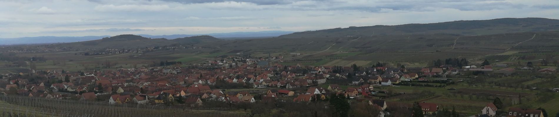
westhoffen

jo-da
Gebruiker
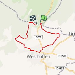

Lengte
5,8 km

Max. hoogte
360 m

Positief hoogteverschil
171 m
Km-Effort
8,1 km

Min. hoogte
208 m

Negatief hoogteverschil
161 m
Boucle
Ja
Datum van aanmaak :
2019-03-03 15:21:46.624
Laatste wijziging :
2019-03-03 17:40:42.286
2h17
Moeilijkheid : Medium

Gratisgps-wandelapplicatie
 SityTrail
IGN / Geografische instituten
SityTrail Plus
De wereld gaat voor u open
Over ons
Tocht Stappen van 5,8 km beschikbaar op Grand Est, Bas-Rhin, Westhoffen. Deze tocht wordt voorgesteld door jo-da.
Foto's


Plaatsbepaling
Land:
France
Regio :
Grand Est
Departement/Provincie :
Bas-Rhin
Gemeente :
Westhoffen
Locatie:
Unknown
Vertrek:(Dec)
Vertrek:(UTM)
385121 ; 5385858 (32U) N.
Opmerkingen