


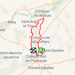
9915756-Chateauneuf en Thymerais 18.29

togolo28
Gebruiker

Lengte
18,3 km

Max. hoogte
217 m

Positief hoogteverschil
166 m
Km-Effort
21 km

Min. hoogte
146 m

Negatief hoogteverschil
167 m
Boucle
Ja
Datum van aanmaak :
2019-05-05 15:49:36.356
Laatste wijziging :
2019-05-05 15:50:33.577
--
Moeilijkheid : Medium

Gratisgps-wandelapplicatie
 SityTrail
IGN / Geografische instituten
SityTrail Plus
De wereld gaat voor u open
Over ons
Tocht Stappen van 18,3 km beschikbaar op Centre-Val de Loire, Eure-et-Loir, Châteauneuf-en-Thymerais. Deze tocht wordt voorgesteld door togolo28.
Plaatsbepaling
Land:
France
Regio :
Centre-Val de Loire
Departement/Provincie :
Eure-et-Loir
Gemeente :
Châteauneuf-en-Thymerais
Locatie:
Unknown
Vertrek:(Dec)
Vertrek:(UTM)
370477 ; 5382906 (31U) N.
Opmerkingen