


St Julien

sallfrey
Gebruiker

Lengte
103 km

Max. hoogte
446 m

Positief hoogteverschil
1304 m
Km-Effort
120 km

Min. hoogte
132 m

Negatief hoogteverschil
1311 m
Boucle
Ja
Datum van aanmaak :
2019-05-09 04:59:34.614
Laatste wijziging :
2019-05-09 18:29:45.076
13h25
Moeilijkheid : Heel gemakkelijk

Gratisgps-wandelapplicatie
 SityTrail
IGN / Geografische instituten
SityTrail Plus
De wereld gaat voor u open
Over ons
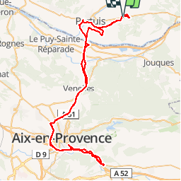
Tocht Auto van 103 km beschikbaar op Provence-Alpes-Côte d'Azur, Vaucluse, La Bastidonne. Deze tocht wordt voorgesteld door sallfrey.
Plaatsbepaling
Land:
France
Regio :
Provence-Alpes-Côte d'Azur
Departement/Provincie :
Vaucluse
Gemeente :
La Bastidonne
Locatie:
Unknown
Vertrek:(Dec)
Vertrek:(UTM)
706897 ; 4841844 (31T) N.
Opmerkingen