


la Rhune

CASSISFRAMBOISE
Gebruiker
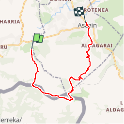

Lengte
12,8 km

Max. hoogte
878 m

Positief hoogteverschil
813 m
Km-Effort
24 km

Min. hoogte
16 m

Negatief hoogteverschil
894 m
Boucle
Neen
Datum van aanmaak :
2019-06-25 07:34:01.753
Laatste wijziging :
2019-06-25 14:56:02.897
5h12
Moeilijkheid : Medium

Gratisgps-wandelapplicatie
 SityTrail
IGN / Geografische instituten
SityTrail Plus
De wereld gaat voor u open
Over ons
Tocht Stappen van 12,8 km beschikbaar op Nieuw-Aquitanië, Pyrénées-Atlantiques, Urrugne. Deze tocht wordt voorgesteld door CASSISFRAMBOISE.
Plaatsbepaling
Land:
France
Regio :
Nieuw-Aquitanië
Departement/Provincie :
Pyrénées-Atlantiques
Gemeente :
Urrugne
Locatie:
Unknown
Vertrek:(Dec)
Vertrek:(UTM)
608622 ; 4798582 (30T) N.
Opmerkingen