Tocht  Cognin-les-Gorges - Gorges du Nan - Cascade de la Gerlette - Photo

Gorges du Nan - Cascade de la Gerlette

 Nathy8913
Nathy8913

Gebruiker

© OpenStreetMap contributors
Lengte
Lengte
11,8 km
Max. hoogte
Max. hoogte
959 m
Positief hoogteverschil
972 m
Km-Effort
Km-Effort  
25 km
Min. hoogte
Min. hoogte
282 m
Negatief hoogteverschil
972 m
Boucle
Boucle
Ja
Datum van aanmaak :
2019-07-15 13:12:40.15
Laatste wijziging :
2019-07-15 13:12:50.723

(0 Bericht)


Scan deze QR-code om de tocht te openen in de SityTrail-applicatie

Gratisgps-wandelapplicatie

Logo SityTrail SityTrail

IGN / Geografische instituten

SityTrail uit de App Store downloaden SityTrail uit Google Play downloaden

Logo SityTrail SityTrail Plus

De wereld gaat voor u open

SityTrail uit de App Store downloaden SityTrail uit Google Play downloaden SityTrail op Huawei AppGallery downloaden

Over ons

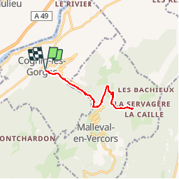
Tocht van 11,8 km beschikbaar op Auvergne-Rhône-Alpes, Isère, Cognin-les-Gorges. Deze tocht wordt voorgesteld door Nathy8913.

Hoogteprofiel

POI's

POI Cognin-les-Gorges - Parking de Cognin (au choix) - Photo
Nathy8913
COGNIN-LES-GORGES 
POI Malleval-en-Vercors - Accès au Nan - Photo
Nathy8913
MALLEVAL-EN-VERCORS 
POI Malleval-en-Vercors - Le Moulin - Photo
Nathy8913
MALLEVAL-EN-VERCORS 
POI Malleval-en-Vercors -  Carrefour cascad - Photo
Nathy8913
MALLEVAL-EN-VERCORS 
POI Malleval-en-Vercors - Cascade de la Gerlette - Photo
Nathy8913
MALLEVAL-EN-VERCORS 
POI Malleval-en-Vercors - Fond du cirque - Photo
Nathy8913
MALLEVAL-EN-VERCORS 
POI Cognin-les-Gorges - Parking de Cognin (au choix) - Photo
Nathy8913
COGNIN-LES-GORGES 

Plaatsbepaling

Land:
France
Regio :
Auvergne-Rhône-Alpes
Departement/Provincie :
Isère
Gemeente :
Cognin-les-Gorges
Locatie:
Unknown
Vertrek:(Dec)
Vertrek:(UTM)
689635 ; 5004591 (31T) N.


Sluiten
Mijn abonnementen