


SityTrail - J6 - Rif Brentei -- Rif Pedrotti-F

GAPIAN43
Gebruiker
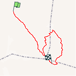

Lengte
7,5 km

Max. hoogte
2858 m

Positief hoogteverschil
966 m
Km-Effort
19,4 km

Min. hoogte
2170 m

Negatief hoogteverschil
665 m
Boucle
Neen
Datum van aanmaak :
2019-07-27 08:36:40.957
Laatste wijziging :
2019-08-05 07:15:35.825
--
Moeilijkheid : Moeilijk

Gratisgps-wandelapplicatie
 SityTrail
IGN / Geografische instituten
SityTrail Plus
De wereld gaat voor u open
Over ons
Tocht Via ferrata van 7,5 km beschikbaar op Trento-Zuid-Tirol, Provincia di Trento, Tre Ville. Deze tocht wordt voorgesteld door GAPIAN43.
Plaatsbepaling
Land:
Italy
Regio :
Trento-Zuid-Tirol
Departement/Provincie :
Provincia di Trento
Gemeente :
Tre Ville
Locatie:
Unknown
Vertrek:(Dec)
Vertrek:(UTM)
644819 ; 5115232 (32T) N.
Opmerkingen