


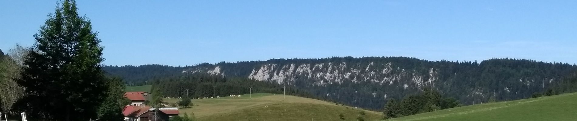
Étape 8 : Vieux Chateleu à les Alliés

annefrance70
Gebruiker
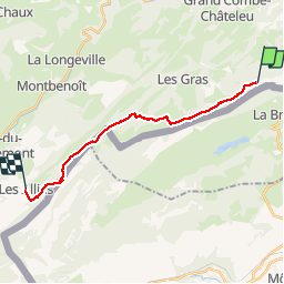

Lengte
16,1 km

Max. hoogte
1224 m

Positief hoogteverschil
394 m
Km-Effort
22 km

Min. hoogte
933 m

Negatief hoogteverschil
607 m
Boucle
Neen
Datum van aanmaak :
2019-08-04 07:27:04.203
Laatste wijziging :
2019-08-04 19:46:48.543
5h00
Moeilijkheid : Gemakkelijk

Gratisgps-wandelapplicatie
 SityTrail
IGN / Geografische instituten
SityTrail Plus
De wereld gaat voor u open
Over ons
Tocht Stappen van 16,1 km beschikbaar op Bourgondië-Franche-Comté, Doubs, Grand'Combe-Châteleu. Deze tocht wordt voorgesteld door annefrance70.
Foto's

Plaatsbepaling
Land:
France
Regio :
Bourgondië-Franche-Comté
Departement/Provincie :
Doubs
Gemeente :
Grand'Combe-Châteleu
Locatie:
Unknown
Vertrek:(Dec)
Vertrek:(UTM)
316809 ; 5207233 (32T) N.
Opmerkingen