


6 la bastide puylaurent-les alpiers

joelinou
Gebruiker
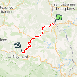

Lengte
27 km

Max. hoogte
1417 m

Positief hoogteverschil
902 m
Km-Effort
39 km

Min. hoogte
1018 m

Negatief hoogteverschil
746 m
Boucle
Neen
Datum van aanmaak :
2019-08-08 18:06:25.614
Laatste wijziging :
2019-08-08 18:07:19.265
--
Moeilijkheid : Moeilijk

Gratisgps-wandelapplicatie
 SityTrail
IGN / Geografische instituten
SityTrail Plus
De wereld gaat voor u open
Over ons
Tocht Te voet van 27 km beschikbaar op Occitanië, Lozère, La Bastide-Puylaurent. Deze tocht wordt voorgesteld door joelinou.
Beschrijving
GR70 STEVENSON
Plaatsbepaling
Land:
France
Regio :
Occitanië
Departement/Provincie :
Lozère
Gemeente :
La Bastide-Puylaurent
Locatie:
Unknown
Vertrek:(Dec)
Vertrek:(UTM)
571853 ; 4938009 (31T) N.
Opmerkingen