


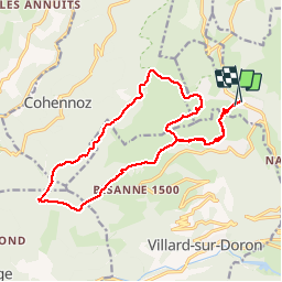
sous Bisanne au lac des Saisies

syl_34
Gebruiker

Lengte
18,1 km

Max. hoogte
1821 m

Positief hoogteverschil
741 m
Km-Effort
28 km

Min. hoogte
1481 m

Negatief hoogteverschil
730 m
Boucle
Ja
Datum van aanmaak :
2019-08-16 07:52:51.058
Laatste wijziging :
2019-08-16 13:57:16.242
5h36
Moeilijkheid : Medium

Gratisgps-wandelapplicatie
 SityTrail
IGN / Geografische instituten
SityTrail Plus
De wereld gaat voor u open
Over ons
Tocht Stappen van 18,1 km beschikbaar op Auvergne-Rhône-Alpes, Savoie, Hauteluce. Deze tocht wordt voorgesteld door syl_34.
Beschrijving
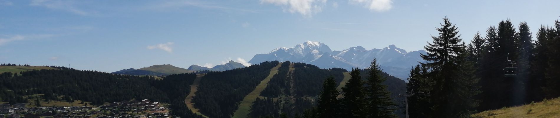
Belle rando avec très belle vue
Foto's


Plaatsbepaling
Land:
France
Regio :
Auvergne-Rhône-Alpes
Departement/Provincie :
Savoie
Gemeente :
Hauteluce
Locatie:
Unknown
Vertrek:(Dec)
Vertrek:(UTM)
308455 ; 5069948 (32T) N.
Opmerkingen
Belle rando, pas de difficultées particulières. Très beau point de vue.