


Lac de Matemale

richardsimopons
Gebruiker

Lengte
148 km

Max. hoogte
1581 m

Positief hoogteverschil
3282 m
Km-Effort
188 km

Min. hoogte
222 m

Negatief hoogteverschil
1965 m
Boucle
Neen
Datum van aanmaak :
2019-08-21 17:31:44.0
Laatste wijziging :
2019-08-22 11:03:29.227
17h25
Moeilijkheid : Onbekend

Gratisgps-wandelapplicatie
 SityTrail
IGN / Geografische instituten
SityTrail Plus
De wereld gaat voor u open
Over ons
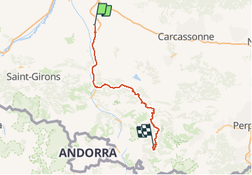
Tocht Stappen van 148 km beschikbaar op Occitanië, Haute-Garonne, Calmont. Deze tocht wordt voorgesteld door richardsimopons.
Beschrijving
Le tour du lac mais zones pastorales empêchent d’ être toujours au bord du lac. Il y a mieux à faire dans la région. Chiffre distance erroné!
Foto's


Plaatsbepaling
Land:
France
Regio :
Occitanië
Departement/Provincie :
Haute-Garonne
Gemeente :
Calmont
Locatie:
Unknown
Vertrek:(Dec)
Vertrek:(UTM)
388716 ; 4792483 (31T) N.
Opmerkingen