


Yellowstone Lower Basin

GOHIER
Gebruiker

Lengte
22 km

Max. hoogte
2255 m

Positief hoogteverschil
190 m
Km-Effort
24 km

Min. hoogte
2203 m

Negatief hoogteverschil
150 m
Boucle
Neen
Datum van aanmaak :
2019-08-31 00:04:16.0
Laatste wijziging :
2019-09-05 22:19:32.864
4h07
Moeilijkheid : Onbekend

Gratisgps-wandelapplicatie
 SityTrail
IGN / Geografische instituten
SityTrail Plus
De wereld gaat voor u open
Over ons
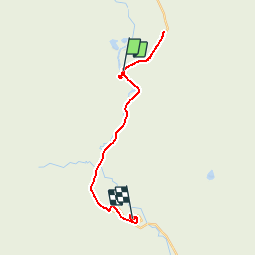
Tocht Stappen van 22 km beschikbaar op Wyoming, Teton County. Deze tocht wordt voorgesteld door GOHIER.
Plaatsbepaling
Land:
United States
Regio :
Wyoming
Departement/Provincie :
Teton County
Gemeente :
Excelsior Geyser Crater
Locatie:
Unknown
Vertrek:(Dec)
Vertrek:(UTM)
513018 ; 4930680 (12T) N.
Opmerkingen