Tocht Stappen Chilliwack - chilliwack1 - Photo
 dath74
dath74

Gebruiker

© OpenStreetMap contributors
Lengte
Lengte
3,2 km
Max. hoogte
Max. hoogte
42 m
Positief hoogteverschil
19 m
Km-Effort
Km-Effort  
3,5 km
Min. hoogte
Min. hoogte
17 m
Negatief hoogteverschil
40 m
Boucle
Boucle
Neen
Datum van aanmaak :
2019-09-02 00:35:38.582
Laatste wijziging :
2019-09-02 01:16:58.502

(0 Bericht)

Stappen
Stappen
40m
Moeilijkheid : Heel gemakkelijk

Scan deze QR-code om de tocht te openen in de SityTrail-applicatie

Gratisgps-wandelapplicatie

Logo SityTrail SityTrail

IGN / Geografische instituten

SityTrail uit de App Store downloaden SityTrail uit Google Play downloaden

Logo SityTrail SityTrail World

De wereld gaat voor u open

SityTrail uit de App Store downloaden SityTrail uit Google Play downloaden SityTrail op Huawei AppGallery downloaden

Over ons

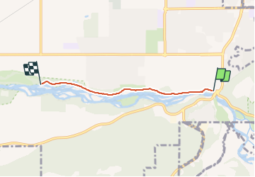
Tocht Stappen van 3,2 km beschikbaar op Brits-Columbia, Fraser Valley Regional District, Chilliwack. Deze tocht wordt voorgesteld door dath74.

Hoogteprofiel

Plaatsbepaling

Land:
Canada
Regio :
Brits-Columbia
Departement/Provincie :
Fraser Valley Regional District
Gemeente :
Chilliwack
Locatie:
Unknown
Vertrek:(UTM)
575562 ; 5438880 (10U) N.

Wandeltochten in de omgeving

Tocht Hybride fiets Chilliwack - vélo chilliwack - Photo
Hybride fiets
dath74

Hybride fiets

Heel gemakkelijk
Chilliwack, Brits-Columbia, Fraser Valley Regional District, Canada
17,9 km | 19,4 km-effort
1h 15min
Neen
Tocht Elektrische fiets Chilliwack - Grey Creek Pass Connector - Photo
Elektrische fiets
xenkod

Elektrische fiets

Heel gemakkelijk
Chilliwack, Brits-Columbia, Fraser Valley Regional District, Canada
70 km | 92 km-effort
Onbekend
Neen


Sluiten
Mijn abonnementen