


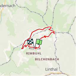
FA Hilsen - Mulermatt - Petit Ballon - Rothenbrunnen - Bockwasen - Col du Hilsenfirst et retour

patrickbeyrath
Gebruiker

Lengte
10,5 km

Max. hoogte
1266 m

Positief hoogteverschil
409 m
Km-Effort
16 km

Min. hoogte
895 m

Negatief hoogteverschil
407 m
Boucle
Ja
Datum van aanmaak :
2019-09-13 05:39:13.963
Laatste wijziging :
2019-09-13 05:49:49.681
--
Moeilijkheid : Medium

Gratisgps-wandelapplicatie
 SityTrail
IGN / Geografische instituten
SityTrail Plus
De wereld gaat voor u open
Over ons
Tocht Te voet van 10,5 km beschikbaar op Grand Est, Haut-Rhin, Linthal. Deze tocht wordt voorgesteld door patrickbeyrath.
Plaatsbepaling
Land:
France
Regio :
Grand Est
Departement/Provincie :
Haut-Rhin
Gemeente :
Linthal
Locatie:
Unknown
Vertrek:(Dec)
Vertrek:(UTM)
358879 ; 5314025 (32T) N.
Opmerkingen