


flagnac numero 2

louis46
Gebruiker
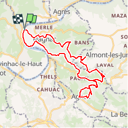

Lengte
20 km

Max. hoogte
404 m

Positief hoogteverschil
657 m
Km-Effort
29 km

Min. hoogte
182 m

Negatief hoogteverschil
654 m
Boucle
Ja
Datum van aanmaak :
2019-09-23 07:29:02.703
Laatste wijziging :
2019-09-23 07:30:46.68
--
Moeilijkheid : Heel gemakkelijk

Gratisgps-wandelapplicatie
 SityTrail
IGN / Geografische instituten
SityTrail Plus
De wereld gaat voor u open
Over ons
Tocht Te voet van 20 km beschikbaar op Occitanië, Aveyron, Flagnac. Deze tocht wordt voorgesteld door louis46.
Plaatsbepaling
Land:
France
Regio :
Occitanië
Departement/Provincie :
Aveyron
Gemeente :
Flagnac
Locatie:
Unknown
Vertrek:(Dec)
Vertrek:(UTM)
439207 ; 4939688 (31T) N.
Opmerkingen