


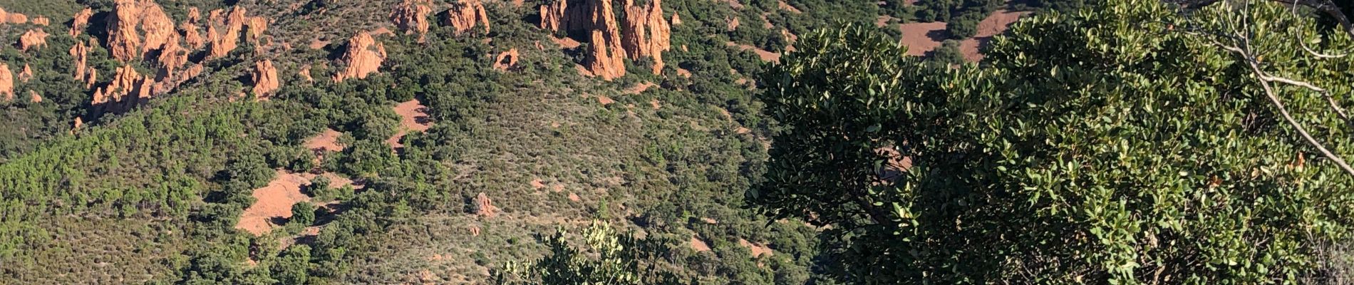
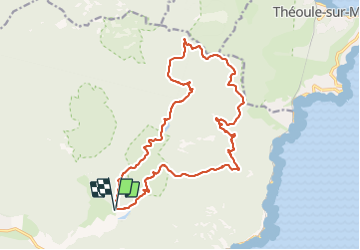
Pic de l’Ours - Col de la Cadière - ancien Lac de l'Ecureuil

JPL8321
Gebruiker

Lengte
22 km

Max. hoogte
486 m

Positief hoogteverschil
706 m
Km-Effort
31 km

Min. hoogte
28 m

Negatief hoogteverschil
705 m
Boucle
Ja
Datum van aanmaak :
2019-10-04 06:26:08.0
Laatste wijziging :
2019-10-04 16:45:24.337
6h53
Moeilijkheid : Zeer moeilijk

Gratisgps-wandelapplicatie
 SityTrail
IGN / Geografische instituten
SityTrail Plus
De wereld gaat voor u open
Over ons
Tocht Stappen van 22 km beschikbaar op Provence-Alpes-Côte d'Azur, Var, Saint-Raphaël. Deze tocht wordt voorgesteld door JPL8321.
Foto's


Plaatsbepaling
Land:
France
Regio :
Provence-Alpes-Côte d'Azur
Departement/Provincie :
Var
Gemeente :
Saint-Raphaël
Locatie:
Unknown
Vertrek:(Dec)
Vertrek:(UTM)
327568 ; 4813724 (32T) N.
Opmerkingen