


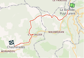
La bastide saint Laurent chasserades

ARVIEU
Gebruiker

Lengte
11,5 km

Max. hoogte
1313 m

Positief hoogteverschil
402 m
Km-Effort
16,4 km

Min. hoogte
1020 m

Negatief hoogteverschil
252 m
Boucle
Neen
Datum van aanmaak :
2019-12-13 07:11:35.838
Laatste wijziging :
2019-12-13 07:12:24.218
4h00
Moeilijkheid : Medium

Gratisgps-wandelapplicatie
 SityTrail
IGN / Geografische instituten
SityTrail Plus
De wereld gaat voor u open
Over ons
Tocht Te voet van 11,5 km beschikbaar op Occitanië, Lozère, La Bastide-Puylaurent. Deze tocht wordt voorgesteld door ARVIEU.
Plaatsbepaling
Land:
France
Regio :
Occitanië
Departement/Provincie :
Lozère
Gemeente :
La Bastide-Puylaurent
Locatie:
Unknown
Vertrek:(Dec)
Vertrek:(UTM)
571857 ; 4937897 (31T) N.
Opmerkingen