![](/images/other/stat-length.png)
![Tocht Stappen Souleuvre-en-Bocage - La vire - Photo](https://media.geolcdn.com/t/1900/400/ext.pjpeg?maxdim=2&url=https%3A%2F%2Fservices.sitytrail.com%2FGeolivesWS%2FDownloadMedia.ashx%3FTrailID%3D228924%26Media%3D8adf6a1c-6bc5-4c7d-8219-3b6296ee4397.jpg)
La vire
albers
Gebruiker
![Lengte](/images/other/stat-length.png)
Lengte
22 km
![Max. hoogte](https://static1.geolcdn.com/siteimages/upload/files/1508320355ic_sort_altitude_max_24dp.png)
Max. hoogte
176 m
![Positief hoogteverschil](https://static1.geolcdn.com/siteimages/upload/files/1508320355ic_sort_den_pos_24dp.png)
Positief hoogteverschil
478 m
![Km-Effort](/images/other/stat-length.png)
Km-Effort
28 km
![Min. hoogte](https://static1.geolcdn.com/siteimages/upload/files/1508320355ic_sort_altitude_min_24dp.png)
Min. hoogte
59 m
![Negatief hoogteverschil](https://static1.geolcdn.com/siteimages/upload/files/1508320355ic_sort_den_neg_24dp.png)
Negatief hoogteverschil
472 m
![Boucle](https://static1.geolcdn.com/siteimages/upload/files/16400158638029165_repeat_loop_refresh_sync_direction_icon.png)
Boucle
Ja
Datum van aanmaak :
2014-12-10 00:00:00.0
Laatste wijziging :
2014-12-10 00:00:00.0
![Stappen](https://static1.geolcdn.com/sitytour/trail-icons/101.png)
5h00
Moeilijkheid : Medium
![Scan deze QR-code om de tocht te openen in de SityTrail-applicatie](https://capi.geolives.com/qq0zvz2zws4bq2lad0pu/sitytour/trails/228924/qr.png?size=200)
Gratisgps-wandelapplicatie
Over ons
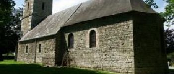
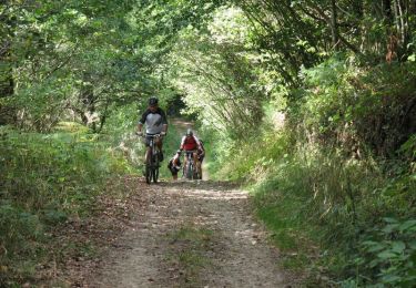
Tocht Stappen van 22 km beschikbaar op Normandië, Calvados, Souleuvre-en-Bocage. Deze tocht wordt voorgesteld door albers.
Beschrijving
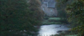
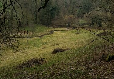
Belle randonnée dans la vallée de la vire.super petit chemin.
le temps affiché est vraiment celui ce que j'ai fait, 5 heure.
départ à 7h15 de campeaux (frontale oblige pendant une bonne heure)
"a vous de jouer".
Plaatsbepaling
Land:
France
Regio :
Normandië
Departement/Provincie :
Calvados
Gemeente :
Souleuvre-en-Bocage
Locatie:
Campeaux
Vertrek:(Dec)
Vertrek:(UTM)
654443 ; 5423888 (30U) N.
Opmerkingen
Wandeltochten in de omgeving
![Tocht Mountainbike Souleuvre-en-Bocage - rando de la souleuvre - Photo](https://media.geolcdn.com/t/375/260/ext.jpg?maxdim=2&url=https%3A%2F%2Fstatic1.geolcdn.com%2Fsiteimages%2Fupload%2Ffiles%2F1524743154velo.jpg)
![Mountainbike Mountainbike](https://static1.geolcdn.com/sitytour/trail-icons/202.png)
rando de la souleuvre
Mountainbike
Medium
(1)
Souleuvre-en-Bocage,
Normandië,
Calvados,
France
![](/images/other/stat-length.png)
25 km | 32 km-effort
2h 7min
![](https://static1.geolcdn.com/siteimages/upload/files/16400158638029165_repeat_loop_refresh_sync_direction_icon.png)
Ja
![Tocht Stappen Souleuvre-en-Bocage - Campeaux - Photo](https://media.geolcdn.com/t/375/260/ext.jpg?maxdim=2&url=https%3A%2F%2Fservices.sitytrail.com%2FGeolivesWS%2FDownloadMedia.ashx%3FTrailID%3D701127%26Media%3Dfix__20170219141411.jpg)
![Stappen Stappen](https://static1.geolcdn.com/sitytour/trail-icons/101.png)
Campeaux
Stappen
Medium
Souleuvre-en-Bocage,
Normandië,
Calvados,
France
![](/images/other/stat-length.png)
18,4 km | 24 km-effort
4h 24min
![](https://static1.geolcdn.com/siteimages/upload/files/16400158638029165_repeat_loop_refresh_sync_direction_icon.png)
Ja
![Tocht Mountainbike Souleuvre-en-Bocage - Le long de la Souleuvre et de la Vire - Campeaux - Photo](https://media.geolcdn.com/t/375/260/ext.jpg?maxdim=2&url=https%3A%2F%2Fservices.sitytrail.com%2FGeolivesWS%2FDownloadMedia.ashx%3FTrailID%3D215151%26Media%3D15746_2.jpg)
![Mountainbike Mountainbike](https://static1.geolcdn.com/sitytour/trail-icons/202.png)
Le long de la Souleuvre et de la Vire - Campeaux
Mountainbike
Moeilijk
Souleuvre-en-Bocage,
Normandië,
Calvados,
France
![](/images/other/stat-length.png)
53 km | 68 km-effort
5h 30min
![](https://static1.geolcdn.com/siteimages/upload/files/16400158638029165_repeat_loop_refresh_sync_direction_icon.png)
Ja
![Tocht Stappen Souleuvre-en-Bocage - carville - Photo](https://media.geolcdn.com/t/375/260/ext.jpg?maxdim=2&url=https%3A%2F%2Fstatic1.geolcdn.com%2Fsiteimages%2Fupload%2Ffiles%2F1553511878bg_sport_marche.png)
![Stappen Stappen](https://static1.geolcdn.com/sitytour/trail-icons/101.png)
carville
Stappen
Gemakkelijk
Souleuvre-en-Bocage,
Normandië,
Calvados,
France
![](/images/other/stat-length.png)
7,7 km | 9,8 km-effort
1h 49min
![](https://static1.geolcdn.com/siteimages/upload/files/16400158638029165_repeat_loop_refresh_sync_direction_icon.png)
Ja
![Tocht Fietstoerisme Souleuvre-en-Bocage - Vélomaritime_Cherbourg_Caen_#J6_20210710_Le_Bény-Bocage_-_Baron-sur-Odon - Photo](https://media.geolcdn.com/t/375/260/ext.jpg?maxdim=2&url=https%3A%2F%2Fmedia.geolcdn.com%2Ff%2F611e26a1-8b8c-4250-a4c5-f0fd0476a185.JPG)
![Fietstoerisme Fietstoerisme](https://static1.geolcdn.com/sitytour/trail-icons/204.png)
Vélomaritime_Cherbourg_Caen_#J6_20210710_Le_Bény-Bocage_-_Baron-sur-Odon
Fietstoerisme
Heel gemakkelijk
Souleuvre-en-Bocage,
Normandië,
Calvados,
France
![](/images/other/stat-length.png)
64 km | 75 km-effort
Onbekend
![](https://static1.geolcdn.com/siteimages/upload/files/16400158638029165_repeat_loop_refresh_sync_direction_icon.png)
Neen
![Tocht Stappen Souleuvre-en-Bocage - le beny bocage - Photo](https://media.geolcdn.com/t/375/260/ext.jpg?maxdim=2&url=https%3A%2F%2Fstatic1.geolcdn.com%2Fsiteimages%2Fupload%2Ffiles%2F1553511878bg_sport_marche.png)
![Stappen Stappen](https://static1.geolcdn.com/sitytour/trail-icons/101.png)
le beny bocage
Stappen
Heel gemakkelijk
Souleuvre-en-Bocage,
Normandië,
Calvados,
France
![](/images/other/stat-length.png)
3,6 km | 5,2 km-effort
2h 2min
![](https://static1.geolcdn.com/siteimages/upload/files/16400158638029165_repeat_loop_refresh_sync_direction_icon.png)
Neen
![Tocht Stappen Souleuvre-en-Bocage - LaVallée de la Souleuvre - Photo](https://media.geolcdn.com/t/375/260/ext.jpg?maxdim=2&url=https%3A%2F%2Fstatic1.geolcdn.com%2Fsiteimages%2Fupload%2Ffiles%2F1553511878bg_sport_marche.png)
![Stappen Stappen](https://static1.geolcdn.com/sitytour/trail-icons/101.png)
LaVallée de la Souleuvre
Stappen
Medium
Souleuvre-en-Bocage,
Normandië,
Calvados,
France
![](/images/other/stat-length.png)
7,2 km | 9,8 km-effort
2h 5min
![](https://static1.geolcdn.com/siteimages/upload/files/16400158638029165_repeat_loop_refresh_sync_direction_icon.png)
Ja
![Tocht Fietstoerisme Souleuvre-en-Bocage - Activity - Photo](https://media.geolcdn.com/t/375/260/ext.jpg?maxdim=2&url=https%3A%2F%2Fstatic1.geolcdn.com%2Fsiteimages%2Fupload%2Ffiles%2F1524743154velo.jpg)
![Fietstoerisme Fietstoerisme](https://static1.geolcdn.com/sitytour/trail-icons/204.png)
Activity
Fietstoerisme
Medium
Souleuvre-en-Bocage,
Normandië,
Calvados,
France
![](/images/other/stat-length.png)
18,2 km | 21 km-effort
Onbekend
![](https://static1.geolcdn.com/siteimages/upload/files/16400158638029165_repeat_loop_refresh_sync_direction_icon.png)
Neen
![Tocht Stappen Souleuvre-en-Bocage - Autour du pont de la Souleuvre - Photo](https://media.geolcdn.com/t/375/260/ext.jpg?maxdim=2&url=https%3A%2F%2Fstatic1.geolcdn.com%2Fsiteimages%2Fupload%2Ffiles%2F1553511878bg_sport_marche.png)
![Stappen Stappen](https://static1.geolcdn.com/sitytour/trail-icons/101.png)
Autour du pont de la Souleuvre
Stappen
Gemakkelijk
Souleuvre-en-Bocage,
Normandië,
Calvados,
France
![](/images/other/stat-length.png)
14,2 km | 18,2 km-effort
3h 11min
![](https://static1.geolcdn.com/siteimages/upload/files/16400158638029165_repeat_loop_refresh_sync_direction_icon.png)
Ja