


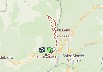
Vacherie des Anduébis de la Colmiane - Valdeblore

GrouGary
Gebruiker

Lengte
10,9 km

Max. hoogte
1900 m

Positief hoogteverschil
540 m
Km-Effort
18,1 km

Min. hoogte
1512 m

Negatief hoogteverschil
534 m
Boucle
Ja
Datum van aanmaak :
2020-01-05 07:41:22.722
Laatste wijziging :
2020-03-16 08:00:56.175
5h04
Moeilijkheid : Moeilijk

Gratisgps-wandelapplicatie
 SityTrail
IGN / Geografische instituten
SityTrail Plus
De wereld gaat voor u open
Over ons
Tocht Stappen van 10,9 km beschikbaar op Provence-Alpes-Côte d'Azur, Alpes-Maritimes, Valdeblore. Deze tocht wordt voorgesteld door GrouGary.
Beschrijving
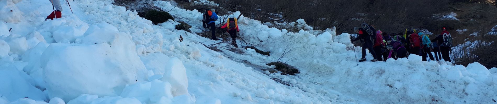
Passages délicats : pente très raide et glacée et une coulée avalancheuse dans l'ubac (retour). Sinon génial sur l'Adret et vacheries (aller).
Foto's


Plaatsbepaling
Land:
France
Regio :
Provence-Alpes-Côte d'Azur
Departement/Provincie :
Alpes-Maritimes
Gemeente :
Valdeblore
Locatie:
Unknown
Vertrek:(Dec)
Vertrek:(UTM)
357722 ; 4881341 (32T) N.
Opmerkingen