


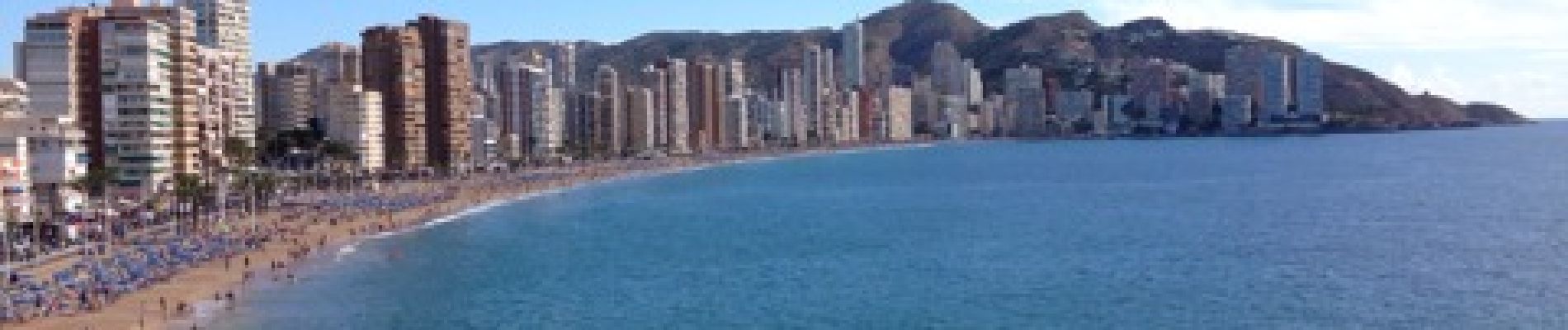
Benidorm Levante Poniente

GARROUSTE
Gebruiker
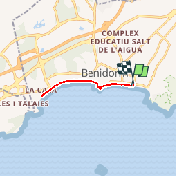

Lengte
9,3 km

Max. hoogte
66 m

Positief hoogteverschil
332 m
Km-Effort
13,8 km

Min. hoogte
-2 m

Negatief hoogteverschil
345 m
Boucle
Ja
Datum van aanmaak :
2014-12-10 00:00:00.0
Laatste wijziging :
2014-12-10 00:00:00.0
1h56
Moeilijkheid : Gemakkelijk

Gratisgps-wandelapplicatie
 SityTrail
IGN / Geografische instituten
SityTrail Plus
De wereld gaat voor u open
Over ons
Tocht Andere activiteiten van 9,3 km beschikbaar op Valencia, Alicante, Benidorm. Deze tocht wordt voorgesteld door GARROUSTE.
Foto's

Plaatsbepaling
Land:
Spain
Regio :
Valencia
Departement/Provincie :
Alicante
Gemeente :
Benidorm
Locatie:
Unknown
Vertrek:(Dec)
Vertrek:(UTM)
751407 ; 4269148 (30S) N.
Opmerkingen