


Garderes-M2-9km

mitch1952
Gebruiker
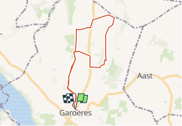

Lengte
8,3 km

Max. hoogte
407 m

Positief hoogteverschil
65 m
Km-Effort
9,2 km

Min. hoogte
371 m

Negatief hoogteverschil
64 m
Boucle
Ja
Datum van aanmaak :
2020-02-05 23:23:52.728
Laatste wijziging :
2022-06-01 19:42:17.202
2h30
Moeilijkheid : Heel gemakkelijk

Gratisgps-wandelapplicatie
 SityTrail
IGN / Geografische instituten
SityTrail Plus
De wereld gaat voor u open
Over ons
Tocht Te voet van 8,3 km beschikbaar op Occitanië, Hautes-Pyrénées, Gardères. Deze tocht wordt voorgesteld door mitch1952.


Plaatsbepaling
Land:
France
Regio :
Occitanië
Departement/Provincie :
Hautes-Pyrénées
Gemeente :
Gardères
Locatie:
Unknown
Vertrek:(Dec)
Vertrek:(UTM)
734312 ; 4796009 (30T) N.
Opmerkingen