


luc

bouscaillou
Gebruiker
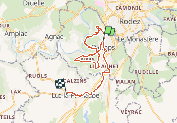

Lengte
16,4 km

Max. hoogte
684 m

Positief hoogteverschil
311 m
Km-Effort
20 km

Min. hoogte
535 m

Negatief hoogteverschil
241 m
Boucle
Neen
Datum van aanmaak :
2020-03-03 13:04:37.093
Laatste wijziging :
2020-03-03 20:33:26.216
7h22
Moeilijkheid : Heel gemakkelijk

Gratisgps-wandelapplicatie
 SityTrail
IGN / Geografische instituten
SityTrail Plus
De wereld gaat voor u open
Over ons
Tocht Noords wandelen van 16,4 km beschikbaar op Occitanië, Aveyron, Olemps. Deze tocht wordt voorgesteld door bouscaillou.
Plaatsbepaling
Land:
France
Regio :
Occitanië
Departement/Provincie :
Aveyron
Gemeente :
Olemps
Locatie:
Unknown
Vertrek:(Dec)
Vertrek:(UTM)
464446 ; 4909848 (31T) N.
Opmerkingen