


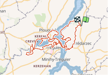
20/03/2020.TREGUIER.De Carpont & du Jaudy au Guindy.Virtuel

babeth35
Gebruiker

Lengte
28 km

Max. hoogte
67 m

Positief hoogteverschil
530 m
Km-Effort
35 km

Min. hoogte
-1 m

Negatief hoogteverschil
530 m
Boucle
Ja
Datum van aanmaak :
2020-03-20 16:12:25.606
Laatste wijziging :
2020-03-26 16:11:40.589
--
Moeilijkheid : Medium

Gratisgps-wandelapplicatie
 SityTrail
IGN / Geografische instituten
SityTrail Plus
De wereld gaat voor u open
Over ons
Tocht Te voet van 28 km beschikbaar op Bretagne, Côtes-d'Armor, Trédarzec. Deze tocht wordt voorgesteld door babeth35.
Plaatsbepaling
Land:
France
Regio :
Bretagne
Departement/Provincie :
Côtes-d'Armor
Gemeente :
Trédarzec
Locatie:
Unknown
Vertrek:(Dec)
Vertrek:(UTM)
485330 ; 5405279 (30U) N.
Opmerkingen