


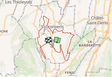
Parcours 11 : Les Châteaux / Attalens

Marginal
Gebruiker

Lengte
18 km

Max. hoogte
997 m

Positief hoogteverschil
511 m
Km-Effort
25 km

Min. hoogte
699 m

Negatief hoogteverschil
512 m
Boucle
Ja
Datum van aanmaak :
2014-12-11 00:00:00.0
Laatste wijziging :
2014-12-11 00:00:00.0
2h00
Moeilijkheid : Onbekend

Gratisgps-wandelapplicatie
 SityTrail
IGN / Geografische instituten
SityTrail Plus
De wereld gaat voor u open
Over ons
Tocht Mountainbike van 18 km beschikbaar op Fribourg/Freiburg, District de la Veveyse, Attalens. Deze tocht wordt voorgesteld door Marginal.
Beschrijving
Parcours VTT autour d''Attalens et de ses châteaux
Plaatsbepaling
Land:
Switzerland
Regio :
Fribourg/Freiburg
Departement/Provincie :
District de la Veveyse
Gemeente :
Attalens
Locatie:
Unknown
Vertrek:(Dec)
Vertrek:(UTM)
335074 ; 5152502 (32T) N.
Opmerkingen