


2013 12 30 Boucle cross longue part 2

staubalex
Gebruiker

Lengte
33 km

Max. hoogte
276 m

Positief hoogteverschil
257 m
Km-Effort
36 km

Min. hoogte
182 m

Negatief hoogteverschil
168 m
Boucle
Neen
Datum van aanmaak :
2014-12-10 00:00:00.0
Laatste wijziging :
2014-12-10 00:00:00.0
2h27
Moeilijkheid : Moeilijk

Gratisgps-wandelapplicatie
 SityTrail
IGN / Geografische instituten
SityTrail Plus
De wereld gaat voor u open
Over ons
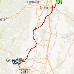
Tocht Mountainbike van 33 km beschikbaar op Grand Est, Haut-Rhin, Horbourg-Wihr. Deze tocht wordt voorgesteld door staubalex.
Plaatsbepaling
Land:
France
Regio :
Grand Est
Departement/Provincie :
Haut-Rhin
Gemeente :
Horbourg-Wihr
Locatie:
Unknown
Vertrek:(Dec)
Vertrek:(UTM)
380618 ; 5325973 (32U) N.
Opmerkingen