


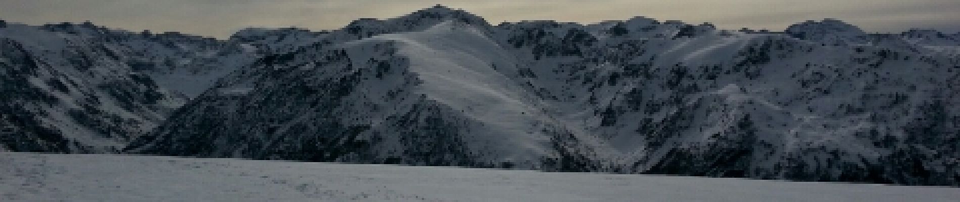
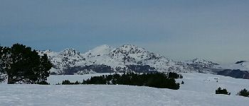
Plateau de Beille - L'ours

pilou31
Gebruiker
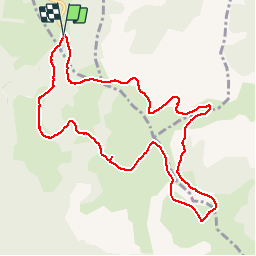

Lengte
11,5 km

Max. hoogte
1984 m

Positief hoogteverschil
408 m
Km-Effort
17 km

Min. hoogte
1723 m

Negatief hoogteverschil
403 m
Boucle
Ja
Datum van aanmaak :
2014-12-10 00:00:00.0
Laatste wijziging :
2014-12-10 00:00:00.0
3h29
Moeilijkheid : Medium

Gratisgps-wandelapplicatie
 SityTrail
IGN / Geografische instituten
SityTrail Plus
De wereld gaat voor u open
Over ons
Tocht Noords wandelen van 11,5 km beschikbaar op Occitanië, Ariège, Albiès. Deze tocht wordt voorgesteld door pilou31.
Beschrijving
Rando raquettes
Foto's


Plaatsbepaling
Land:
France
Regio :
Occitanië
Departement/Provincie :
Ariège
Gemeente :
Albiès
Locatie:
Unknown
Vertrek:(Dec)
Vertrek:(UTM)
392831 ; 4731015 (31T) N.
Opmerkingen
Excellent, simple, rapide, fiable... Je recommande