


ACTIVE LOG 003

mitch1952
Gebruiker
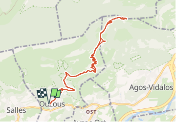

Lengte
12,3 km

Max. hoogte
1340 m

Positief hoogteverschil
809 m
Km-Effort
23 km

Min. hoogte
580 m

Negatief hoogteverschil
809 m
Boucle
Ja
Datum van aanmaak :
2020-05-27 11:31:41.437
Laatste wijziging :
2022-06-07 09:53:12.169
2h30
Moeilijkheid : Medium

Gratisgps-wandelapplicatie
 SityTrail
IGN / Geografische instituten
SityTrail Plus
De wereld gaat voor u open
Over ons
Tocht Te voet van 12,3 km beschikbaar op Occitanië, Hautes-Pyrénées, Ouzous. Deze tocht wordt voorgesteld door mitch1952.
Plaatsbepaling
Land:
France
Regio :
Occitanië
Departement/Provincie :
Hautes-Pyrénées
Gemeente :
Ouzous
Locatie:
Unknown
Vertrek:(Dec)
Vertrek:(UTM)
735624 ; 4768205 (30T) N.
Opmerkingen