


Le Pilhon, Chauvet, montagne blanche

collot
Gebruiker
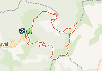

Lengte
10,9 km

Max. hoogte
1685 m

Positief hoogteverschil
763 m
Km-Effort
21 km

Min. hoogte
1083 m

Negatief hoogteverschil
755 m
Boucle
Ja
Datum van aanmaak :
2020-06-22 16:11:32.472
Laatste wijziging :
2020-06-22 16:16:43.764
4h13
Moeilijkheid : Medium

Gratisgps-wandelapplicatie
 SityTrail
IGN / Geografische instituten
SityTrail Plus
De wereld gaat voor u open
Over ons
Tocht Stappen van 10,9 km beschikbaar op Auvergne-Rhône-Alpes, Drôme, Val-Maravel. Deze tocht wordt voorgesteld door collot.
Beschrijving
Très belle randonnée avec des panoramas époustouflants !
Amener sa carte top 25, et Michelin pour identifier les sommets proches et lointains.
Plaatsbepaling
Land:
France
Regio :
Auvergne-Rhône-Alpes
Departement/Provincie :
Drôme
Gemeente :
Val-Maravel
Locatie:
Unknown
Vertrek:(Dec)
Vertrek:(UTM)
706421 ; 4941073 (31T) N.
Opmerkingen