


Vacherie de Rimplas - grand circuit

frizou83
Gebruiker

Lengte
18,2 km

Max. hoogte
2134 m

Positief hoogteverschil
1531 m
Km-Effort
39 km

Min. hoogte
996 m

Negatief hoogteverschil
1534 m
Boucle
Ja
Datum van aanmaak :
2020-06-26 15:40:47.241
Laatste wijziging :
2020-06-26 15:49:41.14
3h57
Moeilijkheid : Moeilijk

Gratisgps-wandelapplicatie
 SityTrail
IGN / Geografische instituten
SityTrail Plus
De wereld gaat voor u open
Over ons
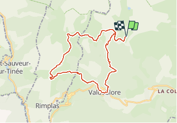
Tocht Stappen van 18,2 km beschikbaar op Provence-Alpes-Côte d'Azur, Alpes-Maritimes, Valdeblore. Deze tocht wordt voorgesteld door frizou83.
Plaatsbepaling
Land:
France
Regio :
Provence-Alpes-Côte d'Azur
Departement/Provincie :
Alpes-Maritimes
Gemeente :
Valdeblore
Locatie:
Unknown
Vertrek:(Dec)
Vertrek:(UTM)
354897 ; 4884417 (32T) N.
Opmerkingen