


Chalencon boucle

alaindurbecq
Gebruiker
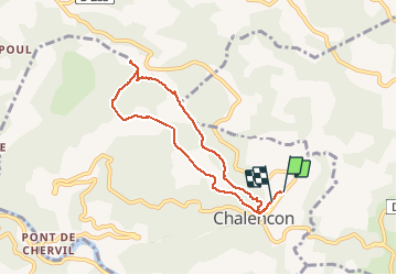

Lengte
7,3 km

Max. hoogte
872 m

Positief hoogteverschil
259 m
Km-Effort
10,7 km

Min. hoogte
707 m

Negatief hoogteverschil
255 m
Boucle
Ja
Datum van aanmaak :
2014-12-10 00:00:00.0
Laatste wijziging :
2014-12-10 00:00:00.0
2h17
Moeilijkheid : Gemakkelijk

Gratisgps-wandelapplicatie
 SityTrail
IGN / Geografische instituten
SityTrail Plus
De wereld gaat voor u open
Over ons
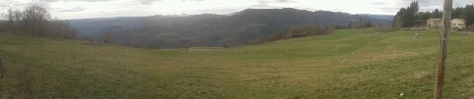
Tocht Stappen van 7,3 km beschikbaar op Auvergne-Rhône-Alpes, Ardèche, Chalencon. Deze tocht wordt voorgesteld door alaindurbecq.
Foto's


Plaatsbepaling
Land:
France
Regio :
Auvergne-Rhône-Alpes
Departement/Provincie :
Ardèche
Gemeente :
Chalencon
Locatie:
Unknown
Vertrek:(Dec)
Vertrek:(UTM)
624599 ; 4970858 (31T) N.
Opmerkingen